Caer Caradoc
If you’ve never visited the hillfort of Caer Caradoc near Church Stretton, prepare yourself for an invigorating climb and stunning views. And weather. It is always windy up on the top and last time we were there we had sleet, rain, hail and sunshine. All along with wind that at some points threatened to blow me off my feet. Even the little dog found it all overwhelming.
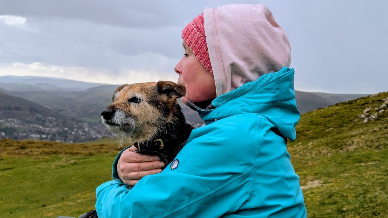
No doubt that it was worth it, though. From Three Fingers Rock, which is on the southern shoulder before the main ridge, the views down to Church Stretton and across to the Long Mynd are spectacular and they only get better the higher you climb.
Caer Caradoc is a volcanic ridge which rises steeply over the Stretton Hills and has accumulated centuries of regional folklore, Arthurian myth, and heroic legends.
The Last Stand of Caratacus: The most famous is that of the British chieftain Caratacus (in Welsh, Caradog), who led native resistance against the Roman conquest in the 1st century AD. Although originally from further east, Caractacus was then the leader of the Silures and Ordovici tribes who occupied lands in modern-day Wales and the Welsh borders.
The Last Battle (AD 50): Local tradition has long held that this specific summit was the site described by the Roman historian Tacitus, where Caratacus made his desperate final stand against the Roman governor Ostorius Scapula. The location, however, is disputed by historians. There is another Caer Caradoc near Chapel Lawn in Shropshire and three sites in Powys/Shropshire borders which also claim association.
Caractacus’s Cave: Just below the summit on the northwest side lies a narrow, natural rock cavity known as Caractacus’s Cave. Folklore claims that following the collapse of his ramparts, Caratacus hid inside this fissure to evade Roman legionaries before fleeing north to seek refuge with Queen Cartimandua of the Brigantes (who subsequently betrayed him). Sadly, this aspect of the cave’s history is unlikely to be true.
The cave is most likely a natural fissure formed by tectonic fracturing and periglacial weathering. While some of Caradoc’s tribes-people may well have used it, mineral prospectors from the sixteenth century onwards probably created its worked roof. There is also a long history of sheep farming in these hills so it may well have been a shelter for shepherds from medieval times onwards, as well as becoming a site of fascination for Victorian antiquarians and modern hikers.
Local Welsh and Marches myths also link Caer Caradoc to early Arthurian lore:
The Hidden Cauldron: A prominent folk tradition connects the cave beneath the hillfort to the magical Cauldron of Di-wrnach (or Dyrnwch the Giant), one of the legendary treasures of Celtic Britain. (If you’ve seen the cave, you’ll know that it is really quite small but perhaps legend would have it that in years gone by it descended further into the hill. Perhaps it did, although modern geologists would dispute any such claims!)
The Treasure Cave: Legend claims the cauldron—filled with royal treasures and a magical sword—was concealed deep within the hollows of Caer Caradoc. This mirrors the early Welsh prose tale Culhwch and Olwen and the poem Preiddeu Annwn (The Spoils of Annwn), wherein King Arthur undertakes a perilous quest to recover the magical vessel. (https://www.roman-britain.co.uk/classical-references/literary-references-for-post-roman-britain/the-spoils-of-annwfn-preiddeu-annwfn/)
Landscape & Geological Lore:
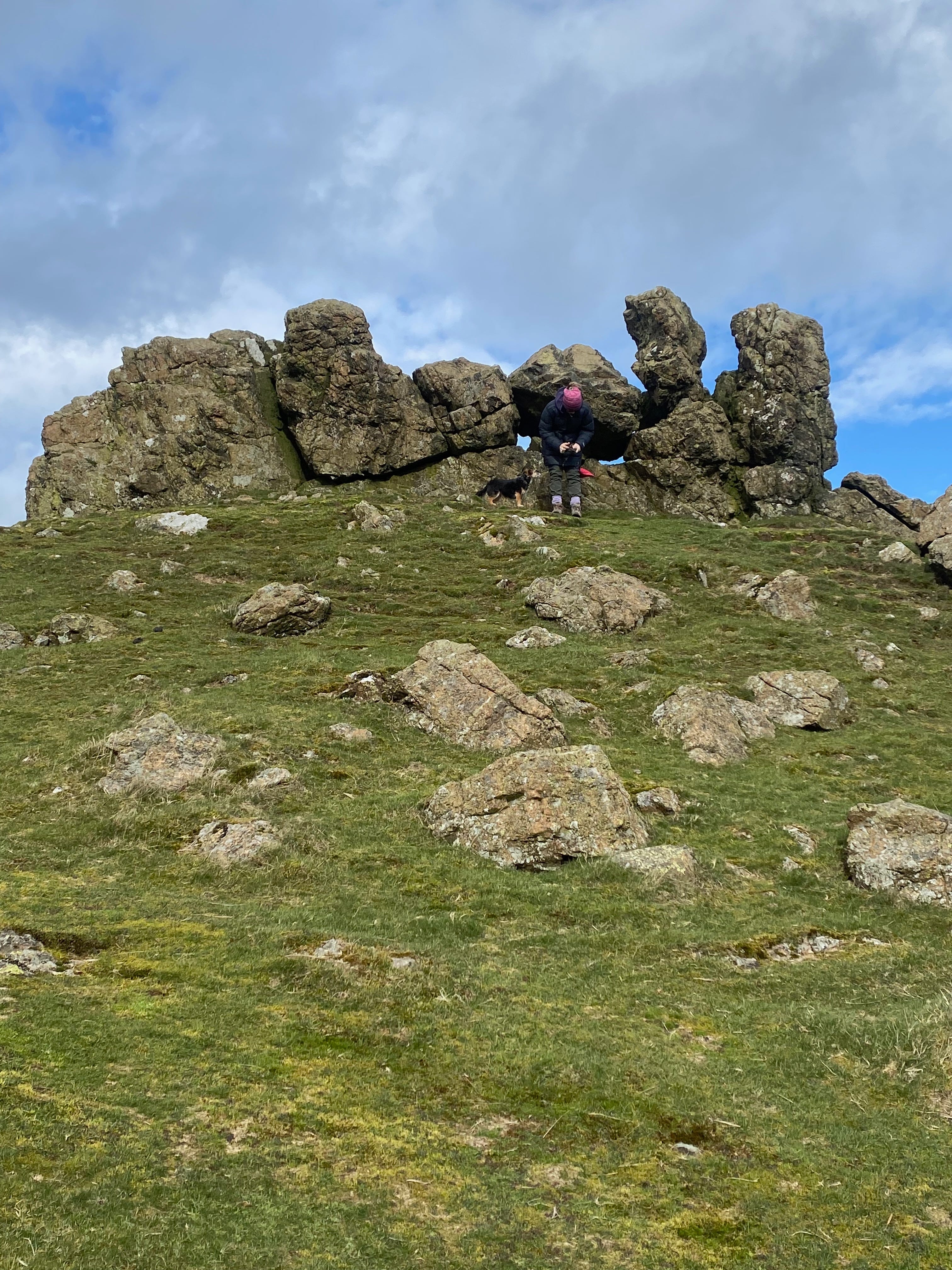
The rugged tor on the hill’s southern shoulder, known as the Three Fingers Rock, has long featured in local storytelling as petrified stone or marks left behind by giants wandering the Shropshire ridge. (There are similar stories about the Battlestones, rocky outcrops on Hope Bowdler Hill, immediately south of Caer Caradoc and part of the same geological feature.
Sentinels of the Gap: In Shropshire regional storytelling, Caer Caradoc and its chain of Stretton peaks (such as Ragleth Hill, Hope Bowdler and the Lawley) were often personified as ancient guardians watching over the ancient passage along the Church Stretton fault line.
There is so much rich geology, history and folklore associated with the hill that I will cover more in a further piece. But if you’ve got your walking legs on, I can’t recommend a better place from which to view the South Shropshire landscape. It is also part of the Stretton Summits challenge, an 18.5 mile route with 4000 metres of ascent that is open for anyone to walk (or run, if you’re a super-fit fell-runner). https://www.visitshropshire.co.uk/whats-on/the-stretton-summits-round/ or find details at The Outdoor Depot on Sandford Avenue in Church Stretton (https://www.theoutdoordepot.co.uk/blog/the-outdoor-depot-stretton-summits-round/)
If you’re interested in a sneak preview, I came across this Youtube video recently:
And if this has whetted your appetite, here is an excerpt from the British Geological Survey’s entry on the Church Stretton Valley: https://webapps.bgs.ac.uk/Memoirs/docs/B01746.html
· The ground is divided from N.E. to S.W. by the Church Stretton valley which carries the railway line between Ludlow and Shrewsbury, and also the line of the main road along an old Roman route leading to the settlement of Uriconian near Shrewsbury. At Church Stretton there is a watershed in the valley bottom at about 620 ft O.D., dividing streams which flow northwards to the River Severn from the southward drainage of tributaries of the River Teme. The valley is bounded to the W. by the Long Mynd plateau, which reaches 1695 ft O.D. at Pole Bank and which carries an ancient trackway, the Port Way, to the N. and S. of the summit. South of Stanbatch the plateau is limited to the W. by a steep scarp about 400 ft high and trending almost N.–S. along the line of the Long Mynd Scarp Fault. This steep slope and the prevailing westerly winds create conditions favourable to the activities of the Midland Gliding Club with its headquarters situated near the Port Way at the top of the scarp. The eastern part of the Long Mynd is deeply dissected by a series of narrow valleys, locally known as batches, draining south-eastwards to the Church Stretton valley and well known to many visitors to the district. To the E. the valley is dominated by a line of narrow hills from Ragleth Hill in the S. to The Lawley in the N., reaching a maximum height of 1500 ft O.D. in Caer Caradoc Hill, crowned by the ramparts of an Iron Age camp. This line of hills is composed mainly of Uriconian rocks the outcrops of which are bounded largely by the component faults of the Church Stretton Complex but which also occur N.E. of Hope Bowdler in Hope Bowdler, Willstone and Cardington hills. The ‘vale and edge’ topography of the ground S. of Hope Bowdler and E. of Comley reflects the easterly dip of Ordovician beds of different hardness which crop out in these areas. The low, drift-covered ground between Leebotwood and The Lawley is underlain by shales with thin coal scams of Upper Carboniferous age which were worked in small collieries up to about 1876. Remains of the old pits can be seen N. of Leebotwood and near Botvyle.
Map References for Caer Caradoc, Church Stretton – nr. All Stretton, Shropshire
NGRef: SO477953 OSMap: LR137/138
Thanks for reading Saskia's Substack! Subscribe for free to receive new posts and support my work.